
In a new weekly update for pv magazine, Solcast, a DNV company, reports that Southern Brazil and the northern Andes were irradiance hotspots during March, posting anomalies as high as 30% above the climatological average. The increase came despite intense rainfall causing flooding in other parts of South America.
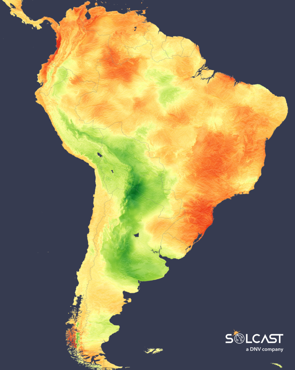
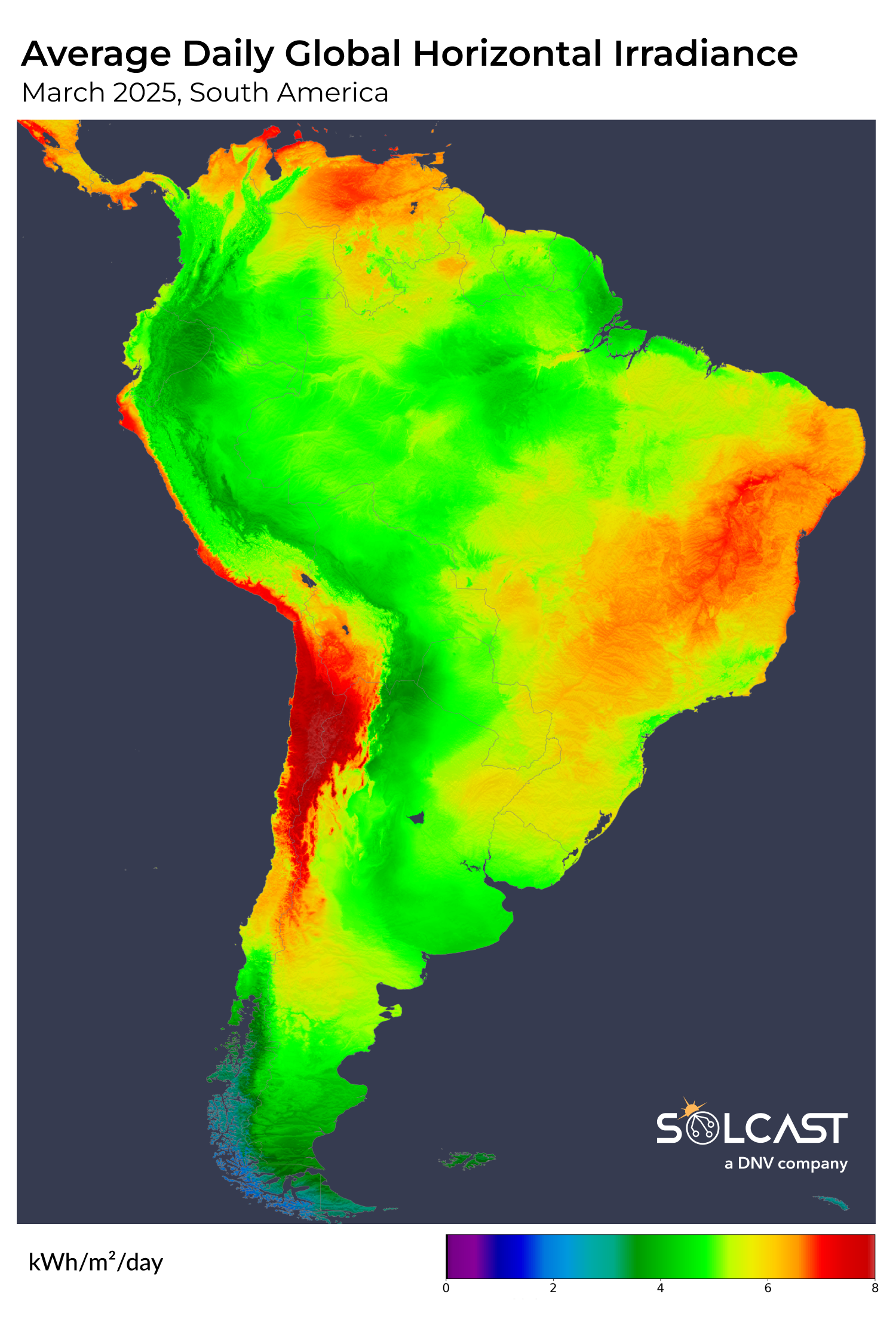
March in South America delivered well above average irradiance for solar producers in Brazil’s solar-dense southeastern states. Most of Brazil, alongside northern South America, benefited from increased irradiance despite persistent convective rain systems dumping above average rainfall in the Amazon. Meanwhile, the Andes in Argentina and the Atacama Desert in Chile saw decreased irradiance, according to analysis using the Solcast API, as high pressure over the southern Atlantic pulled moist air from the east of the continent.
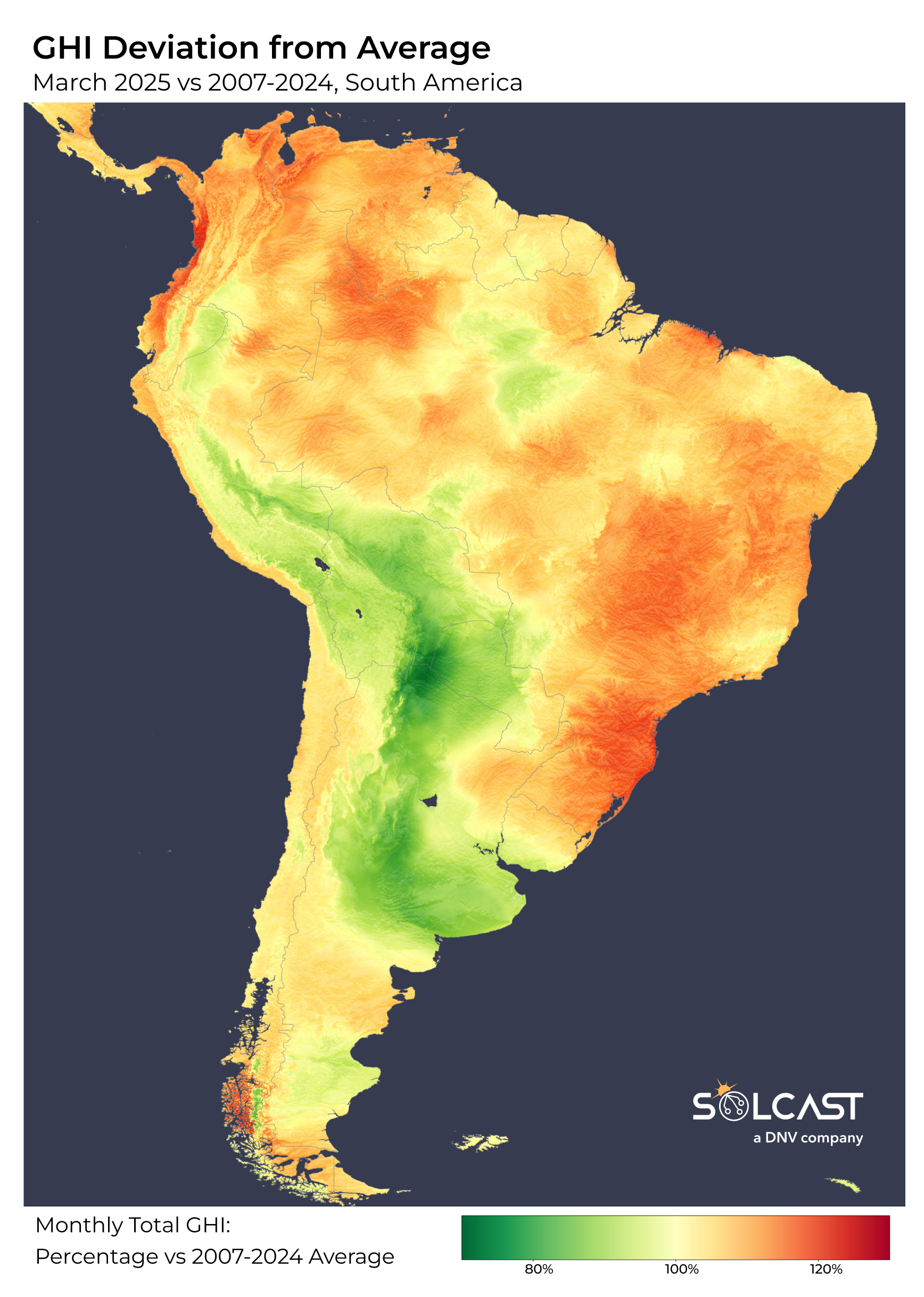
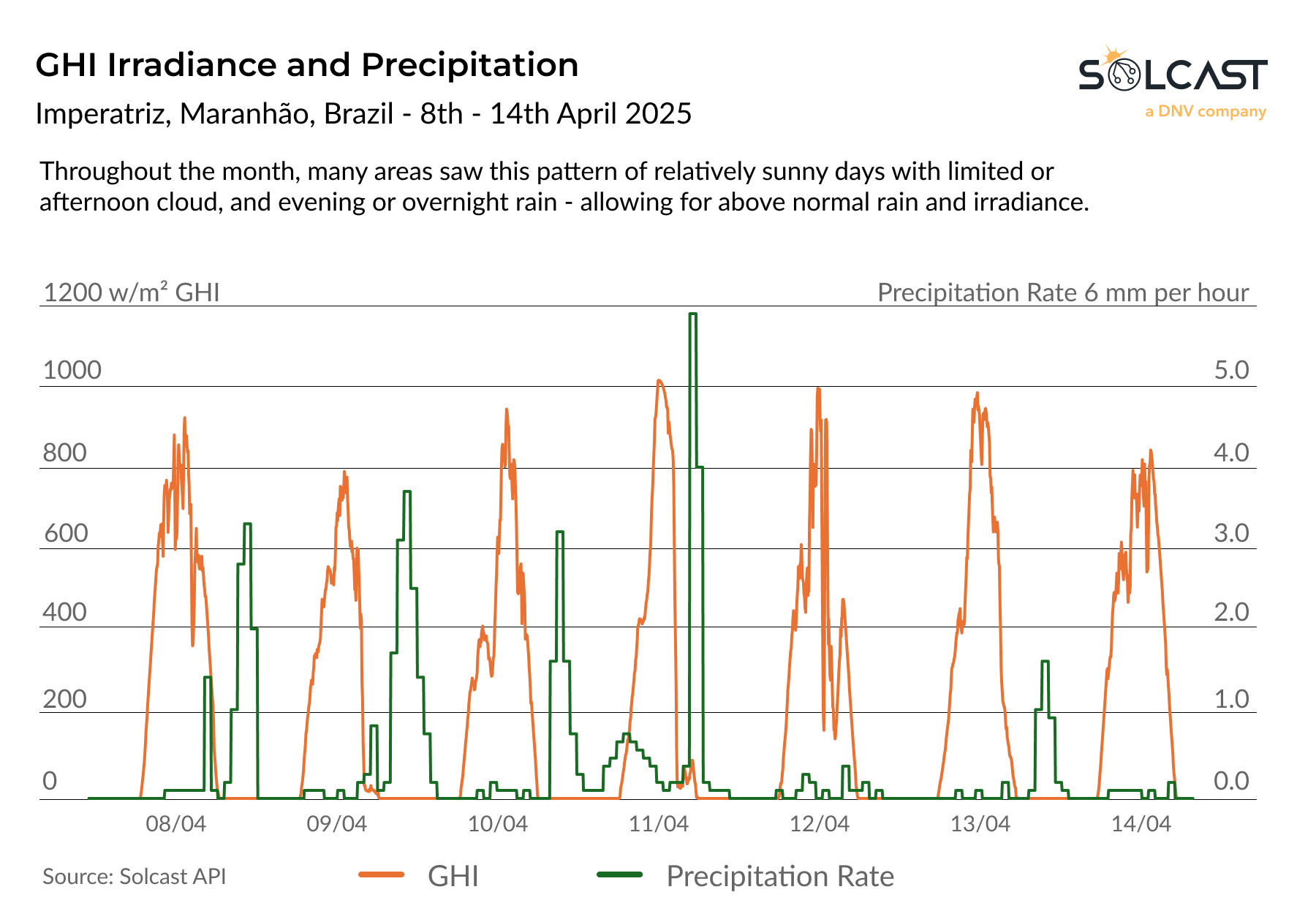
Southern Brazil and the northern Andes stood out as irradiance hotspots during March, posting anomalies as high as 30% above the climatological average. This boost occurred despite intense above-average rainfall leading to flooding in Bolivia, Argentina and Brazil. High rainfall normally means reduced irradiance but in this case, a pronounced ridge of high pressure settled over eastern Brazil which suppressed prolonged cloud cover despite recurring convective rain storm activity. This setup supported sporadic but intense rain, interspersed with extended periods of sunshine. Whilst it’s abnormal to see positive irradiance and rainfall anomalies at the same time, the below graph shows an example week detailing sunny mornings and afternoon cloud, leading to rain late in the day or overnight.
Further north, the Caribbean states also benefited from the same influence, with stable air masses limiting cloud development and pushing irradiance above March averages. Mild temperatures and similar increased precipitation were seen in these areas, though a lack of persistent cloud enhanced solar generation.
In stark contrast, solar conditions were unfavourable across the Andes and adjacent lowlands. Elevated sea surface temperatures in the South Atlantic increased moisture transport west over the continent, funnelling cloud toward the mountains. This air mass encountered a mid- to upper-level trough over the Andes, which destabilized the atmosphere and promoted persistent, deep convective cloud cover throughout the month.
The resulting impact on irradiance was significant. From northern Argentina through Paraguay, Bolivia and into central Peru, cloud-dense conditions prevailed. Irradiance across this zone dropped, with anomalies as low as 30% below climatological averages. This persistent lack of solar exposure represents a key deviation from seasonal expectations for these typically high-performing solar regions.
Solcast produces these figures by tracking clouds and aerosols at 1-2km resolution globally, using satellite data and proprietary AI/ML algorithms. This data is used to drive irradiance models, enabling Solcast to calculate irradiance at high resolution, with typical bias of less than 2%, and also cloud-tracking forecasts. This data is used by more than 350 companies managing over 300 GW of solar assets globally.
The views and opinions expressed in this article are the author’s own, and do not necessarily reflect those held by pv magazine.
This content is protected by copyright and may not be reused. If you want to cooperate with us and would like to reuse some of our content, please contact: editors@pv-magazine.com.
Popular content

Source link